Whether you’re at the beginning of a new construction project, or finishing out your latest masterpiece, UASurvey can assist with aerial modelling of your project.
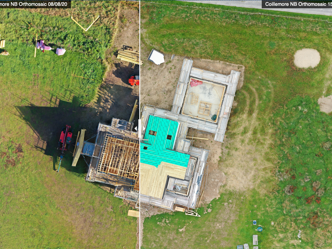
Aerial modelling can showcase your construction location, workplace progress, site features, and more. Investors and buyers alike can obtain a ‘Bird’s Eye View’ of the overall location from start to finish, or they can get a finalized view of the project’s completion.
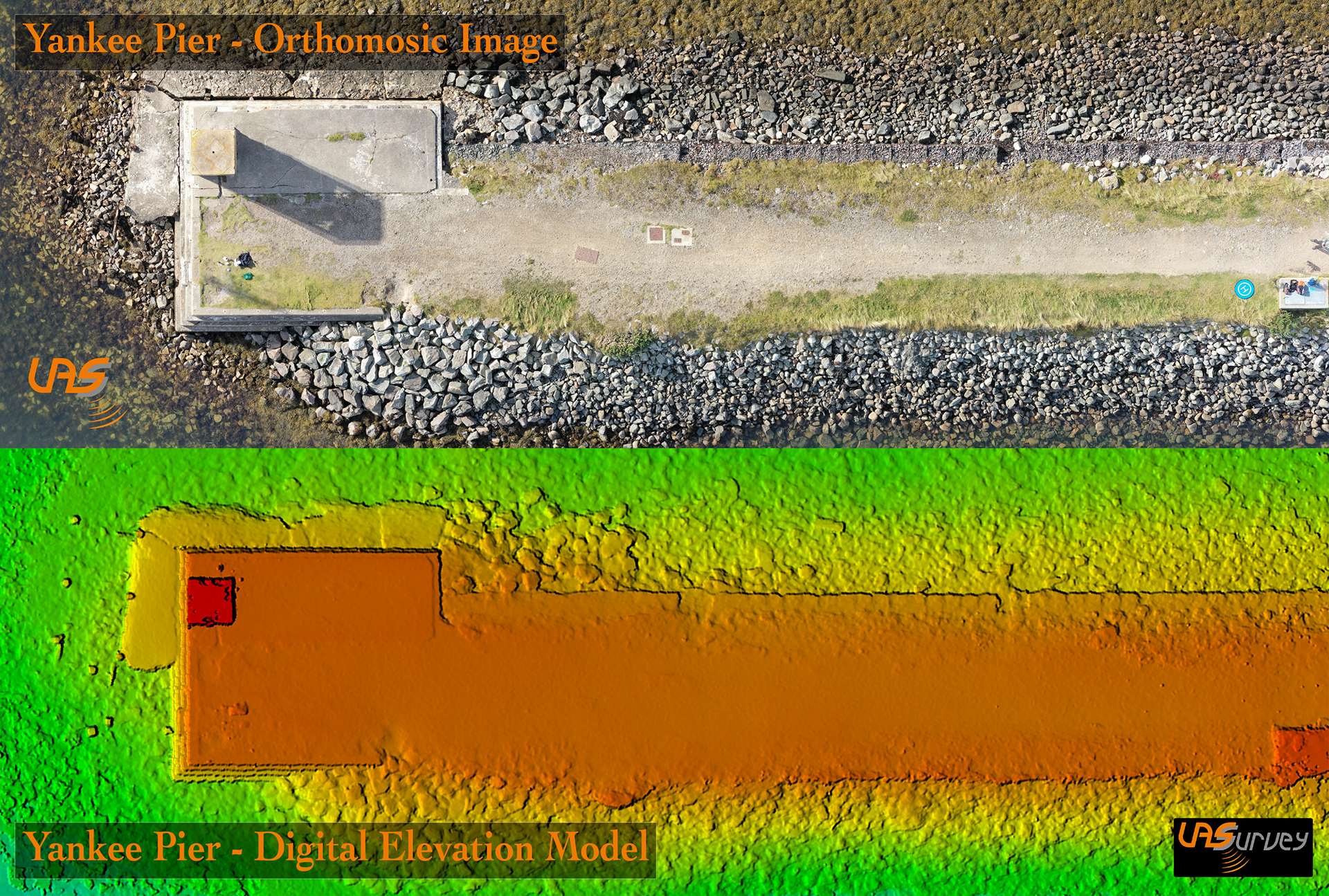
Drone based data collection for site modelling provides much more detail than a Google Map or Google Earth map. Seeing a site with detail on this level can be a compelling marketing feature, and can also be useful in planning developments.
Measurements, acreage, and volumetric measurements are all possible with properly selected targets before any flight begins. Of course, only a licensed land surveyor can interpret measurement data to ensure accuracy and compliance with the region you're building in.
UASurvey will happily supply models from collected data to your survey team and work directly with them for specific data collection needs.
With quality information provided through drone modelling you can save both time and money relaying your project to any interested parties, while increasing workplace safety as well.

UASurvey Disclaimer:
While UASurvey is capable of aerial data collection, visitors should know that we do not interpret survey grade information. For projects where exact measurements count, you still need to rely on a licensed land surveyor or survey engineer. UASurvey can provide data in cooperation with your surveyor, but our data gathering does not replace the need for a licensed land surveyor. This is not exclusive to our business; all drone data collection services cannot interpret data unless they have a surveyor on staff. Additionally, we do not overlay property boundaries on home plots (developed or undeveloped) for sale for the same reasons noted above.